
The Drive
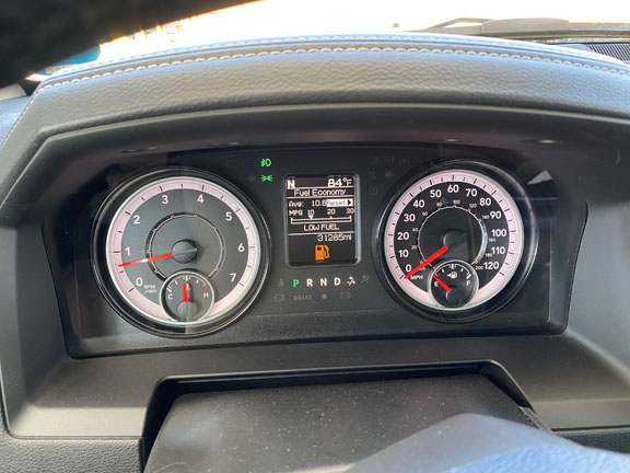
The drive from Edinburg to Del Rio, Texas was not that big a deal. Here’s the thing, the truck is always calculating the distance attainable based on current speed and conditions. So, when Deb asked, “Do we need to stop for gas?” I’m thinking no problem, we have a range for way over a hundred miles left in the tank. It’s only eighty-eight miles to Cotulla. The good computer software people at RAM are telling me right here, right here, here on the dash board, I have plenty of fuel. That, and good ol’ Google maps has the route set. No big deal, piece of cake. Funny thing about speed, weight, and gravity; it varies greatly depending if you are traveling on a flat grade, our mountain grade. The grade increases, the road gets steeper,,,, Oh, My Goodness, should I tell Deb the fuel gauge is dropping faster now than it was thirty minutes ago?
A lot of roads in Texas are posted at 75 MPH. Even in highly populated areas. The merge ramps are close to a half mile long, and the one-way frontage roads paralleling the highways are posted at 55 MPH. The frontage roads will have stop lights, but the inner most lane is a non-stop U-turn lane that circles you under a bridge, and directly onto the fifty-five MPH frontage road going the opposite direction. I like that. Back to my drive to Cotulla. For greater gas mileage I slowed to 50 MPH. I’m sure all the good ol’ boys passing me were thinking, “Get off the road old timer.” Even granny in her Mustang gave me a dirty look. Kidding.
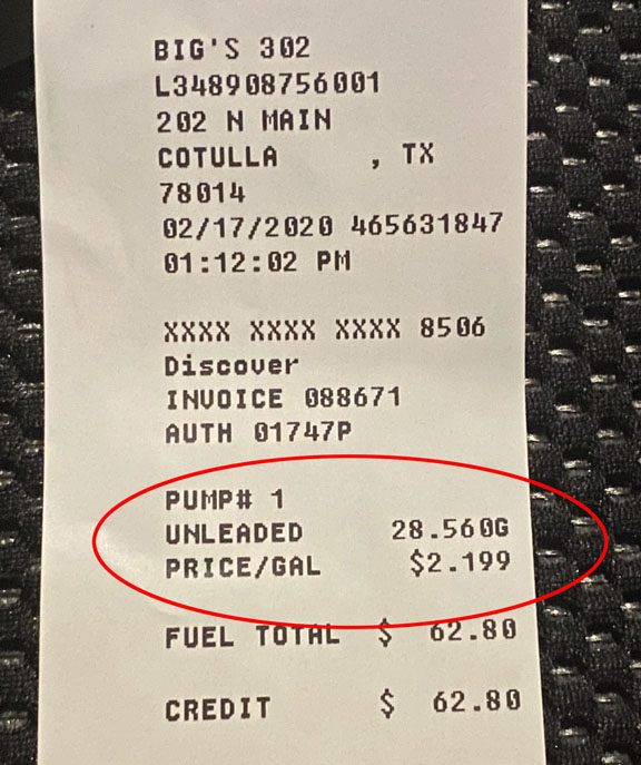
I’m sure we are all familiar with the “Ding” that signifies a fifty-mile driving range before you run out of gas, right. The RAM “Dings.” I watched the readout reduce from a fifty mile range to twenty miles. At twenty miles it simply reads, low fuel. Now it’s an unknown. The RAM truck navigation system has a gas station finder feature, it shows name, distance, and price. Sitting at a stop light in Cotulla, looking at Big’s gas station, I pointed to the display and said, “Hey Deb, it looks like there is gas three cents cheaper down the road.” “Don’t you dare.” We made it to Cotulla with a little less than two gallons.
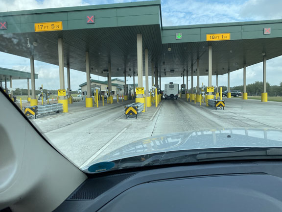
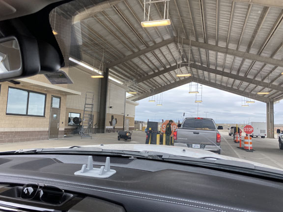
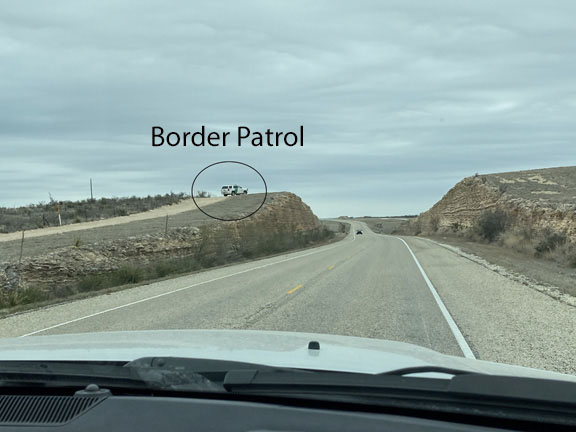
Checkpoint
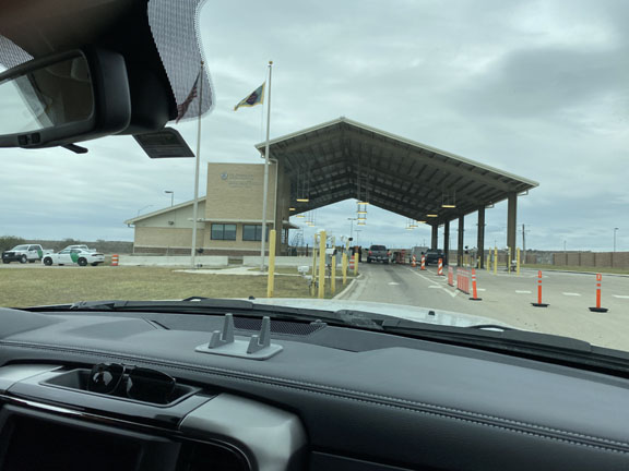
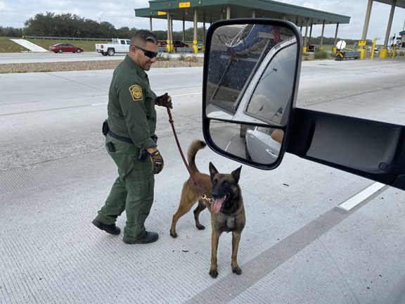
There are eighteen permanent Border Patrol interior checkpoints in Texas. It is not an option to go around, the road leads directly into the checkpoint. Often there is a K9 handler, and then an agent. I asked the first agent about photographing his canine, his response, “Sure, please don’t get out of the vehicle.” The whole check point Charlie experience lasts about thirty-five seconds.
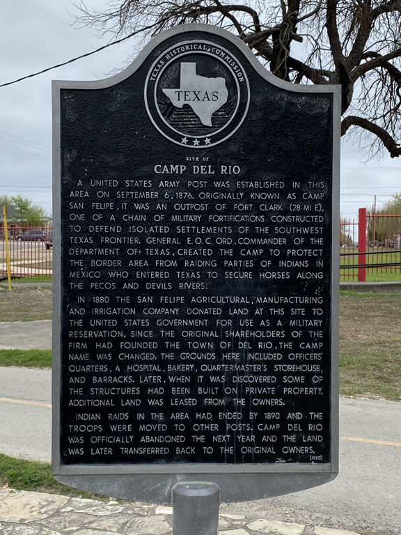
Del Rio, Texas
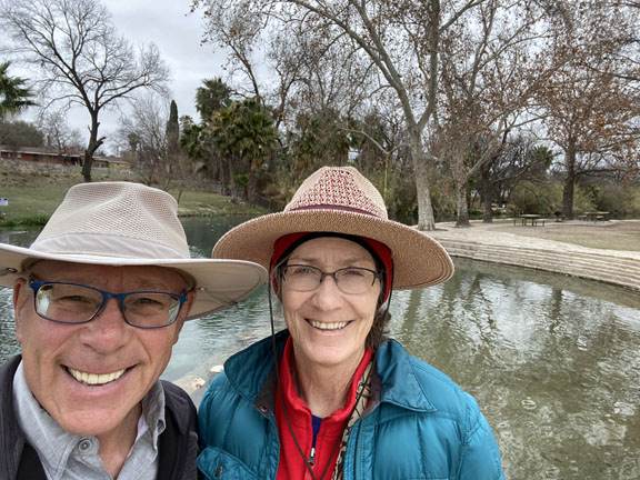
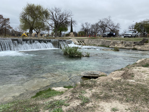
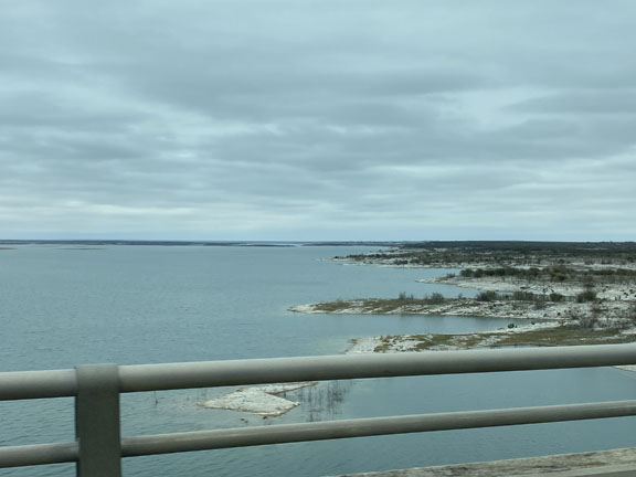
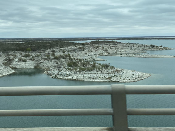
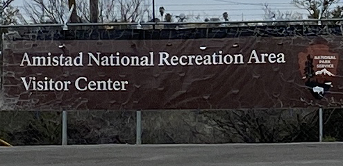
Our time in Del Rio was cold and grey. We walked along the San Felipe Springs right in Del Rio, and then several trails in the Amistad National Recreation Area. The Amistad National Recreation Area includes the area around the Amistad Reservoir at the confluence of the Rio Grande, the Devils River, and the Pecos River near Del Rio in Val Verde County, Texas. We were hoping to kayak here, and considered it, but it was way to cold.
We had a heck of a time finding the large visitor center. The road signs, and Google maps kept directing us to an abandoned building. The visitor center had moved, and silly us being focused on what we were being told drove past it several times.
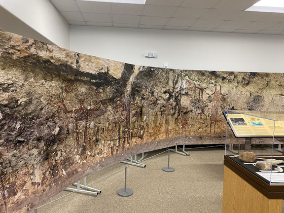
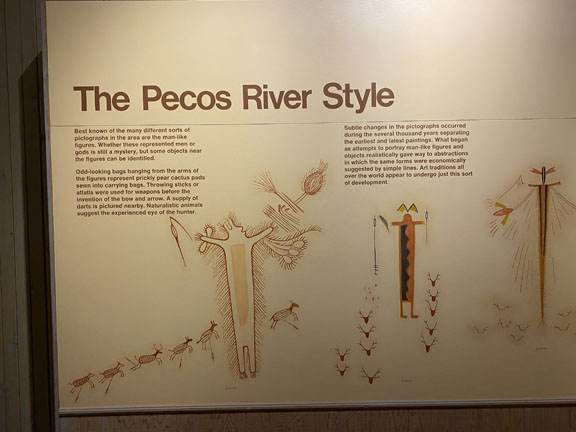
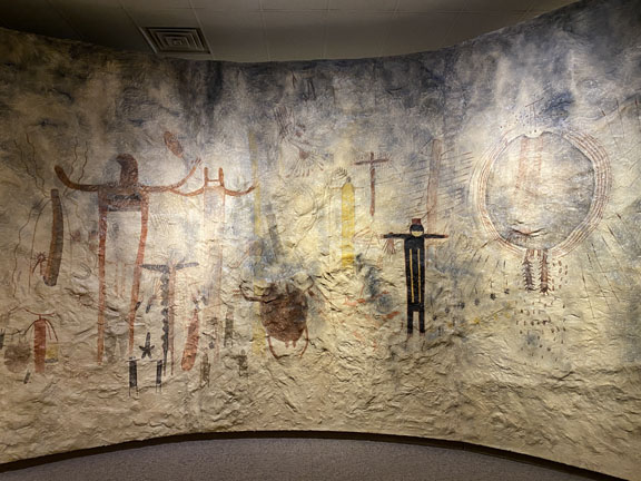
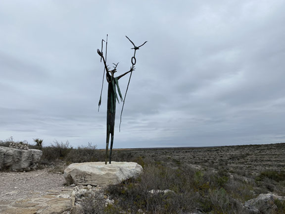
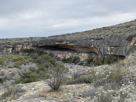
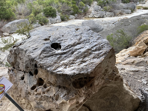
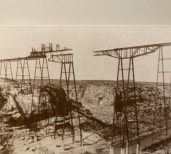
Seminole Canyon
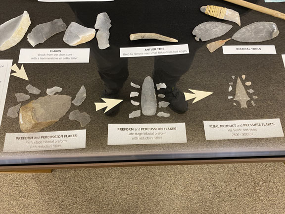
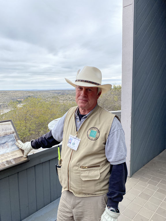
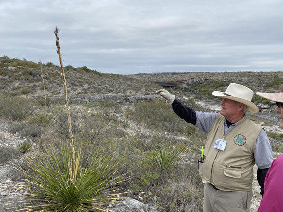
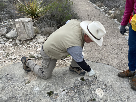
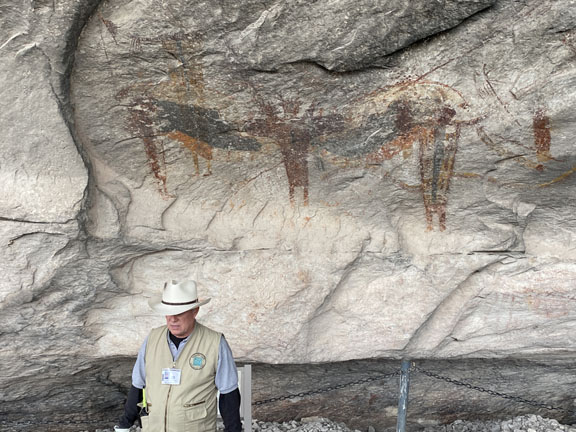
Seminole Canyon State Park and Historic Site was just outside Del Rio, and worth the drive. Access into Seminole and Presa canyons is restricted to guided tours. We were very fortunate to have Tom as our guide. He is a retired geologist who had worked for a large oil company in Houston. Over the years he and his family had visited every state park in Texas. Tom told us how thrilled and honored he was to be chosen for the Seminole tour guide, and it showed. Deb and I were the only guests. Our tour ran long, and the staff had to wait for our return before locking the gate. Nice.
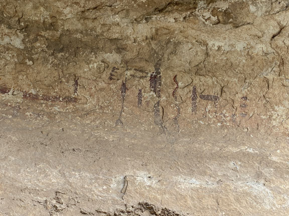
The Pictographs were the highlight, and Tom went into great detail of what the times were like four thousand years ago when the Archaic people inhabited the area.

More photos


